Village Plan for Newbold Verdon 1964
Newbold Verdon has developed over the years and is again going through a period of
change, hopefully the essence and character of the village will remain strong.
The interesting thing about the Parish Archive is that we have the opportunity to look back on the documents that show the thoughts of those who came before us. Below is a shortened version of the 1964 Village Plan prepared by the County Planning Officer.
The village has at the present time some 2,000 inhabitants. Although there is no large industrial or commercial concern in the village, public transport facilities to the main centres of employment are quite good.
There are several big buildings of architectural or historic interest, the most notable being
The Hall and Saint James Church that form a considerable character. The recent rebuilding of
the Church tower has been particularly successful.
There are two non-conformist chapels on Main Street. A good parish playing field some 53⁄4
acres on Dragon Lane, and a working men’s club in Main St. Shopping facilities are
reasonably diverse and mainly concentrated on Main Street.
The village was quite a compact settlement until the late 1920s with the working
population mainly employed in agriculture and coal mining. Prior to 1939 there was limited
housing development on Desford Road and in the early post war years the rural District
Council provided a large number of new houses on two estates between Barlestone Road and
Main Street. The reason for this quantity of accommodation at what was previously a relatively
small village was because of its relation to the coal fields and the absence elsewhere to
suitable stable building land.
As a result of these extensions the physical structure of the village has become unbalanced. Improvement of this condition has been the construction of a private estate of some 90 dwellings now nearer completion on the South side of Main Street. There is evidence of a continued demand for housing in Newbold Verdon. A reasonable amount of additional development can be accommodated here without
overwhelming the existing community.
Having regard to the above considerations the plan allocations a total 39.4 acres of land for residential use, mainly on the South side of Main Street with limited development on the West side of Brascote Lane. These allocated areas when developed will accommodate some 1200 persons bringing the total village population up to 3200.
The new development areas will enable the expansion of village to take place without adversely affecting the very pleasant character. A scheme is at present being prepared for the enlargement of the sewage disposal works.
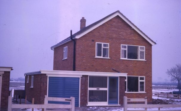
The full two-page document is available to view in the Archive Catalogue HERE. The photograph above shows a new build property in Peters Avenue from 1964.